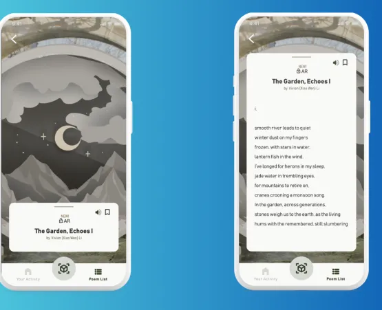
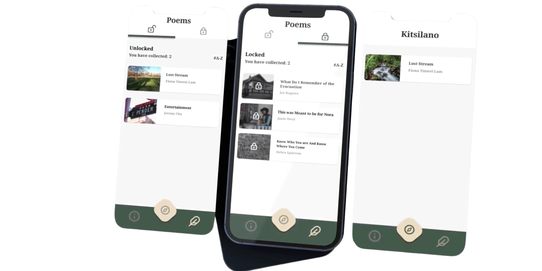
Master of Digital Media (MDM) students have created an award-winning immersive experience that connects people to site-specific poetry with an innovative app that uses geo-location technologies.
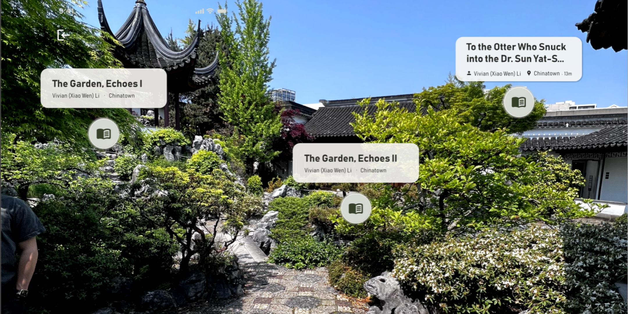
The app offers an augmented reality experience for poetry listeners to gain a sense of connection between the physical and digital world. By using geo-location to engage poetry in the same location it was written, listeners can extend and deepen the meaning of the poem through the synergy of sounds, nature, time, and the spoken word, creating something unique that can’t be offered by an exclusively digital product.
“Poetry is, and has always been, an element of every human culture,” says Jonathan Hennessy, MDM alumnus, and designer and researcher on this project. “It’s part of what makes us who we are. So, it’s inevitable that poetry would find new forms of expression in the digital age. Engaging with poems about and inspired by places within it is a singular opportunity to understand and appreciate where and among whom we live.”
It isn’t just this experience that makes the app unique. The team also had to take a very different approach when it came to integrating maps within the app.
When CeDAR, a unit at UBC’s Institute of Critical Indigenous Studies approached Centre for Digital Media to create an immersive poetry app, on the surface it didn’t seem to require any innovations in design or technology. But when it came time to think about map integration, it brought up a host of questions around our historical relationship with maps.
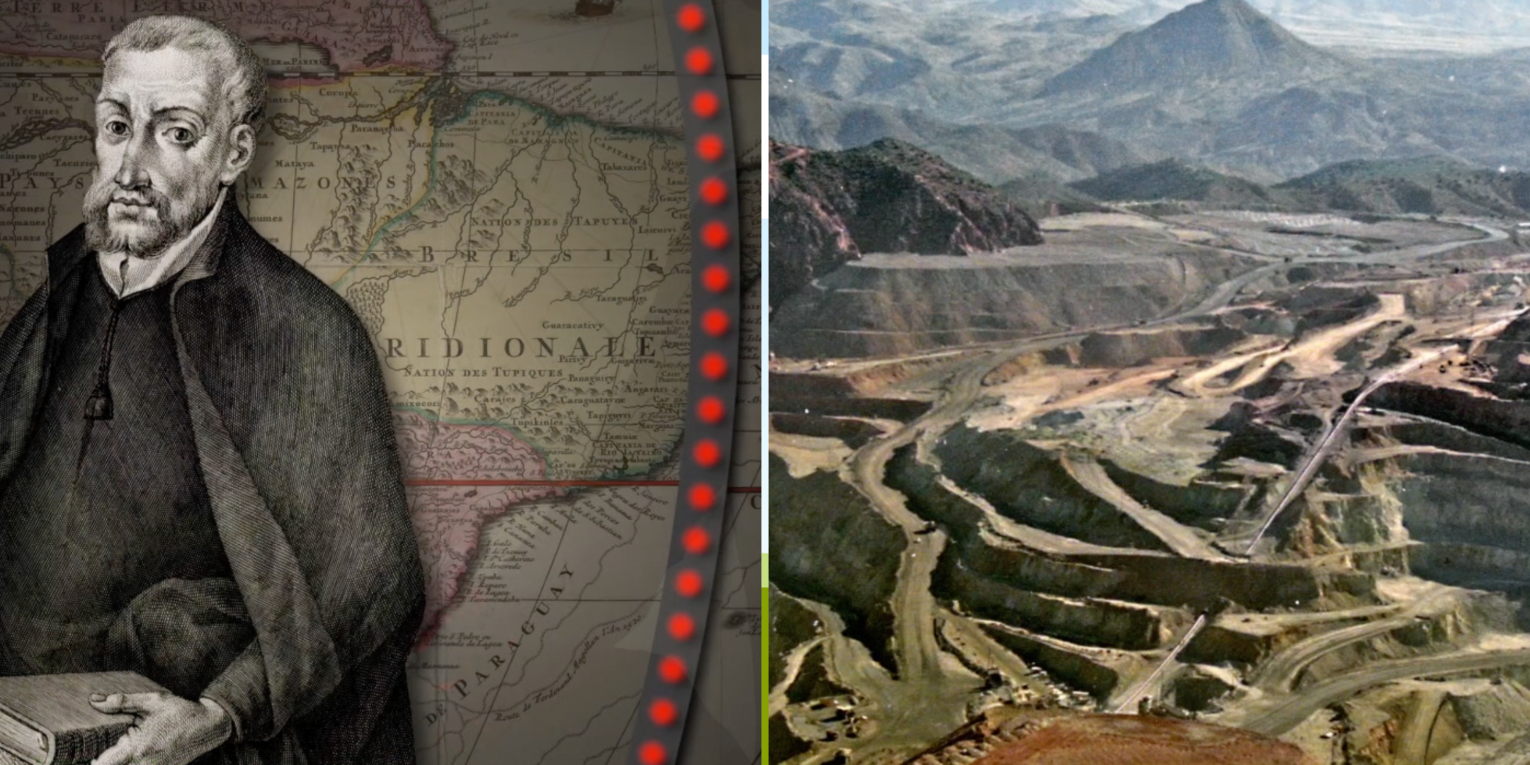
Maps are everywhere online and it’s something we don’t think twice about. We use maps to get to our next destination, find restaurants, or maybe an EV charging station. But we often overlook the reality that maps are the result of centuries of actions and decisions by colonial powers imposing their agendas.
It shapes our relationship to the land, and current maps were in large part a tool to visualize and re-render the world as data that could serve as an aid in extracting resources, apportioning labour, and historically redistributing wealth on a massive scale typically to European powers.
With this in mind, the team conceptualized an interface to locate geo-anchored content that could present space and navigation in a fresh and less problematic way while adhering to CeDAR’s values of providing learning opportunities in a culturally relevant context.
“I’m terrifically proud of the work our team did, and it was wonderful to be recognized by the Horizon Interactive Awards,” says Jonathan. “It shows that our unique values-based approach to innovation is something that is worthy of attention.”
“This project, like so many others in the MDM, not only honed my skills with digital media and enhanced my way of working on a team, but also was a chance to become a more well-rounded individual.”

Meet the Team
SoHyun Park – Project Manager and Product Designer
Alice Kong – Product Owner and Lead Designer
Helen He – 2D Artist, Designer, and 3D Artist
Liam Thorne - Developer
Justin Jao - Developer
Jonathan Hennessey – Content Designer and Researcher
Project Supervisor
Work with our students
Access a multidisciplinary team of students take on an applied technology-focused project to develop prototypes or applications from concept to deliverable.